
Calabasas Peak
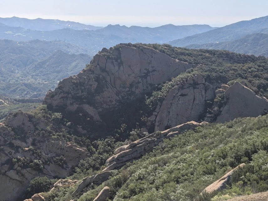
A rich variety of chaparral, punctuated by natural rock formations, highlights this challenging hike along the wide dirt fire road known as Calabasas Peak Motorway.
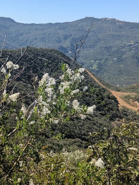
Ceanothus shrubs, ablaze with dainty white flowers in spring, blanket the hillsides, along with spiky purple lupine, coastal sage scrub, Indian red paintbrush and island morning glory.
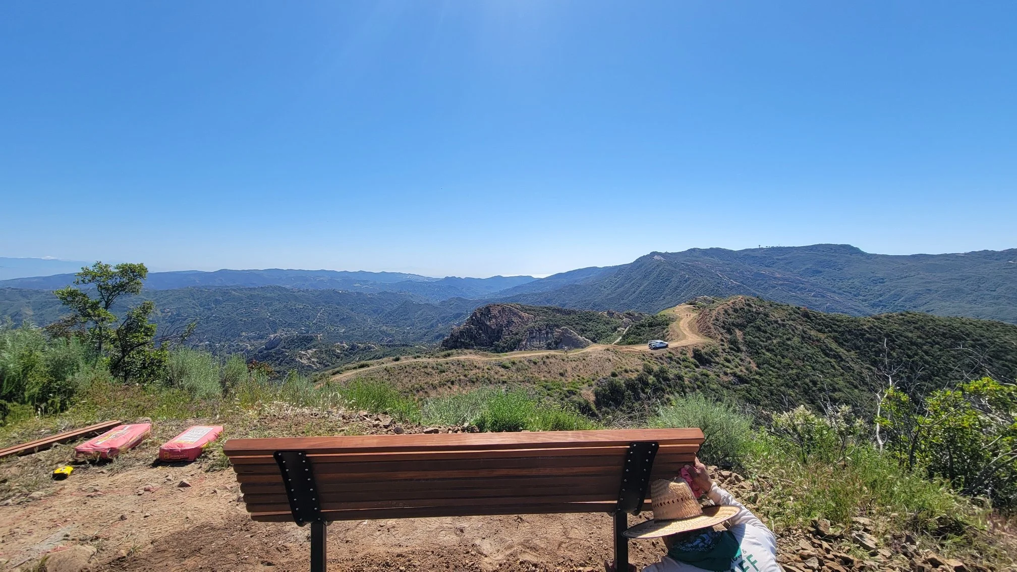
The bench perches high above the fire road, reached by a short but strenuous climb along a single-track trail. Clusters of wild fennel, buckwheat and laurel sumac surround it, without obstructing the views of Calabasas Peak and sightings of other outdoor enthusiasts hiking or biking up the mountain. It’s the perfect vantage point to take in the interior Santa Monica Mountains and its diverse Mediterranean ecosystem.
The Santa Monica Mountains National Recreation Area sustained significant damage from the Woolsey Fire in November 2018. The fire burned almost 100,000 acres of land managed by the National Park Service, California State Parks, the Mountains Recreation and Conservation Authority, and the Santa Monica Mountains Conservancy.
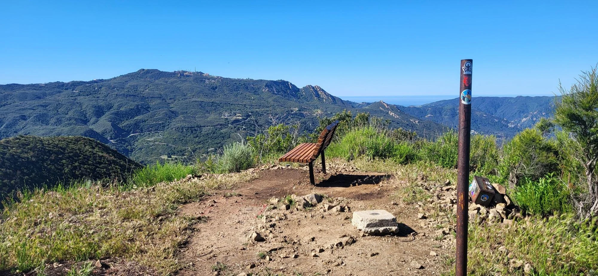
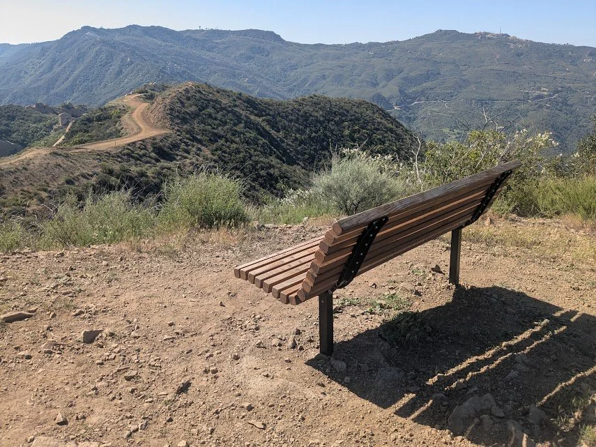
Bench coordinates - 34°06'43.3"N 118°39'09.3"W


-
A steady 2.3-mile ascent with an approximate elevation gain of 1,000 feet leads to the bench and uninhibited mountain and valley views.
The terrain is rocky and steep at times with stretches of loose gravel. Hiking boots with a strong grip are recommended.
There is limited shade; bring sunscreen, hats and plenty of water. WiFi and cellular service is limited.
Expect to share the wide trail with mountain bikers.
Highlights include mountain to sea views, natural rock formations and a variety of native flora and fauna.
-
Free parking along Stunt Roadacross from the trailhead; be sure to pull off the road completely. No public restrooms at trailhead.
-
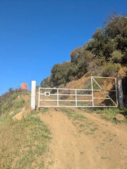
Begin at the fire road gate off Stunt Road, one mile south of Mulholland Drive.
The trail starts a steady ascent north along the fire road. At 0.6 mile, you’ll pass a turnoff for Red Rock Canyon fire road. Continue straight on Calabasas Peak Motorway for another 1.7 miles to a ridge with sweeping views that stretch from the Santa Monica Mountains to the Simi Hills and Santa Susana Mountains to the north.
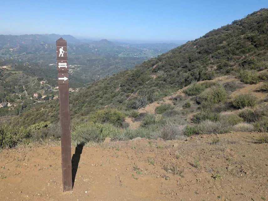
A signpost with a bench symbol sits near the turnoff for the bench. Follow the dirt path uphill to a small clearing on the left, high above the fire road.
-
If you are coming from the I-405 freeway, get off at U.S. Route 101 and follow it north toward Ventura approximately 11 miles to Valley Circle Boulevard. Turn left onto Valley Circle and continue onto Mulholland Drive for about 0.5 mile. Turn right onto Valmar Road and continue as it turns into Old Topanga Canyon Road. Turn right onto Mulholland Drive and follow it 3.8 miles to Stunt Road. Make a left onto Stunt Road and drive for 1 mile to a dirt parking pullout.
The trailhead begins across Stunt Road to the east of the parking pullout.