
Lion crossing pathway
The concept of the Wallis Annenberg Wildlife Crossing at Liberty Canyon began three decades ago, when scientists attached radio collars to mountain lions, bobcats, and coyotes and began tracking their movements. The resulting maps identified the Ventura Freeway (US-101) at Liberty Canyon in Agoura Hills as a primary crossing point for the animals. Much of the surrounding land was privately owned, and local agencies worked together to acquire it and permanently protect it from development. Now in the finishing stages, the bridge – which stretches across 10 lanes of freeway and an access road -- is the final link in the process and will connect the Santa Monica Mountains with the Simi Hills to provide a safe vegetated passage for animals between two critical inter-mountain range habitats.
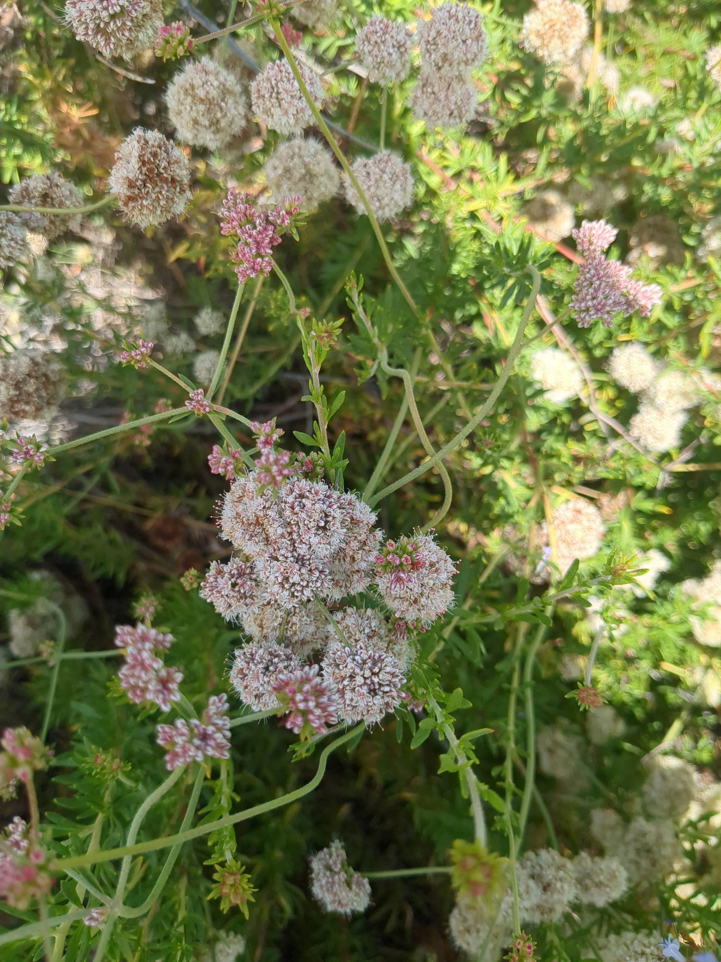
Hike up a short, steep hill to the first bench for a birds’-eye view of the groundbreaking bridge. The bench, the first of three along a challenging one-mile trail ascending south toward the heart of the Santa Monica Mountains, provides a front-row seat to the bridge’s extraordinary journey. Surrounded by California buckwheat, common deerweed and other native plants, the bench is a perfect spot to admire the Old California landscape and witness the unfolding of this bold, collaborative project.
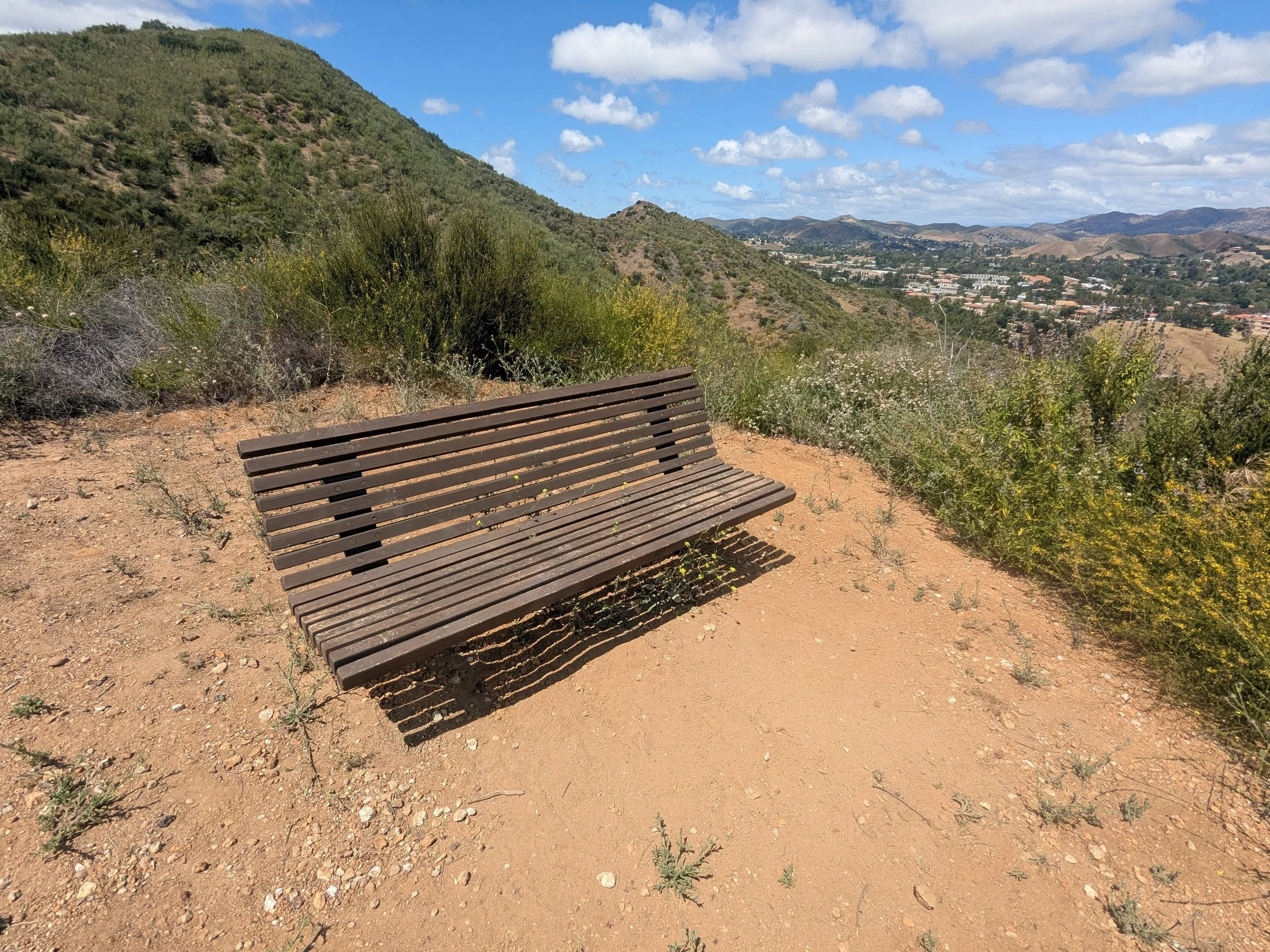
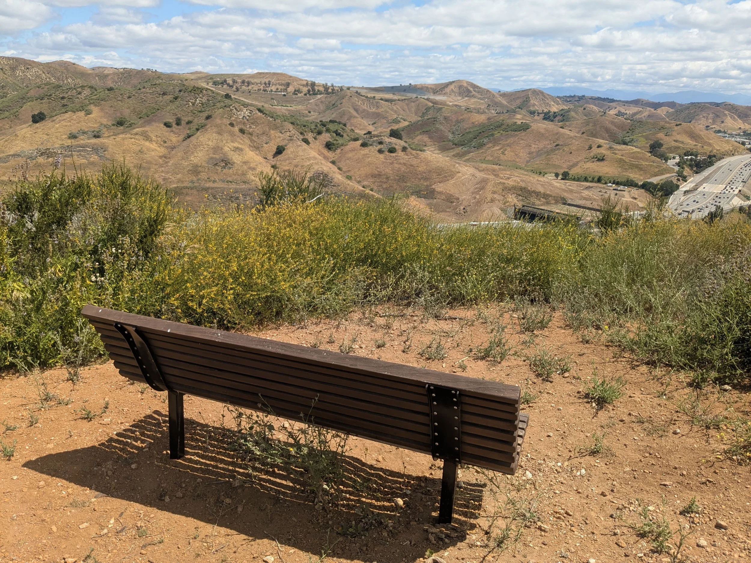
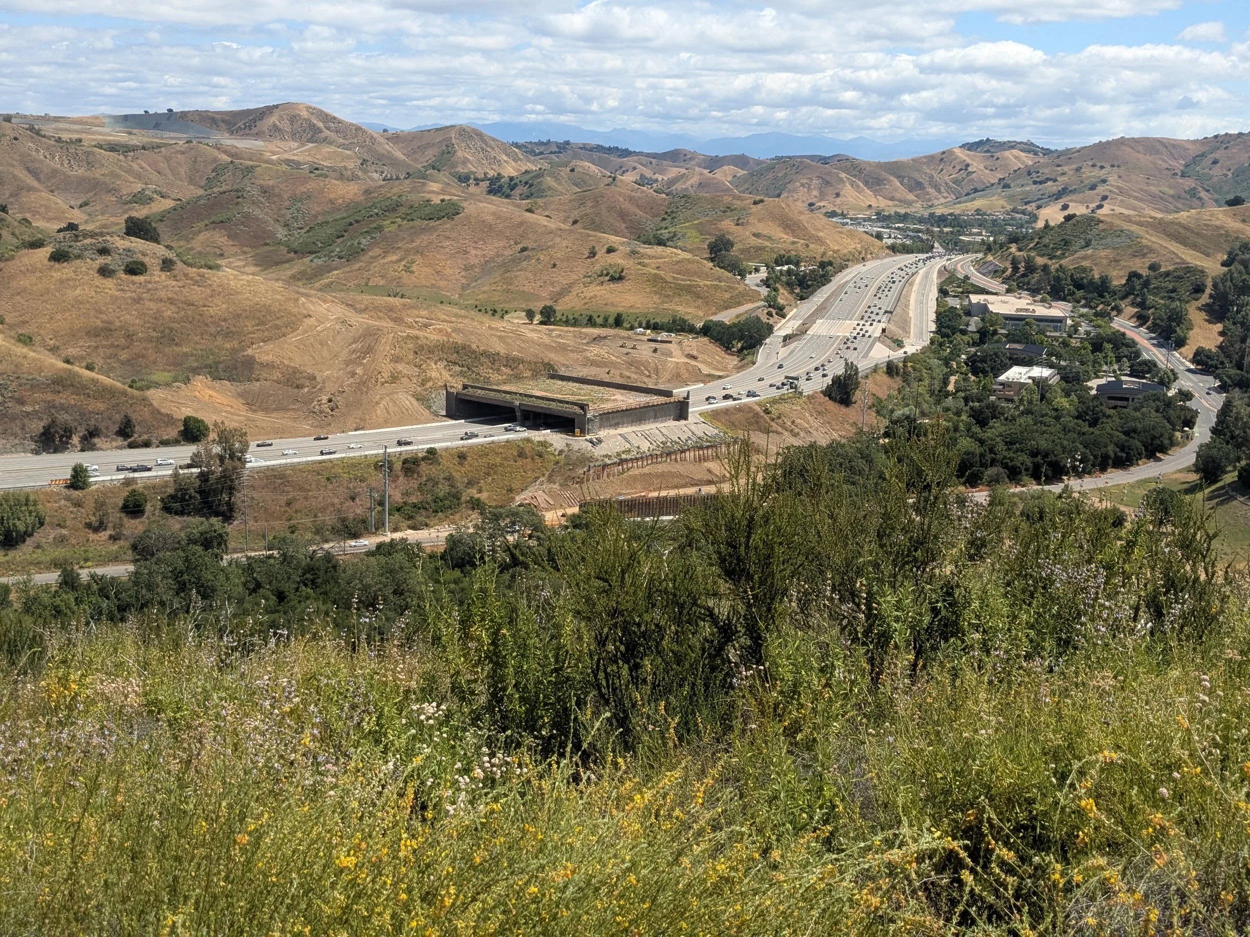
Bench coordinates - 34°08'10.1"N 118°44'00.0"W
-
It’s a short but steady uphill climb to the first bench with views of the wildlife crossing.
The trail is identified as the Abrams Open Space loop on some maps and hiking applications.
The majority of the trail is exposed; bring a hat, sunscreen, and water. Temperatures can reach triple digits in the summer.
Sturdy shoes or hiking boots are recommended.
WiFi and cell service are intermittently available.
The Annenberg Wildlife Crossing is still under construction, with an expected completion date of December 2026. You may encounter delays or closures along Agoura Road.
-
The trail begins just beyond the dirt parking lot off Agoura Road.
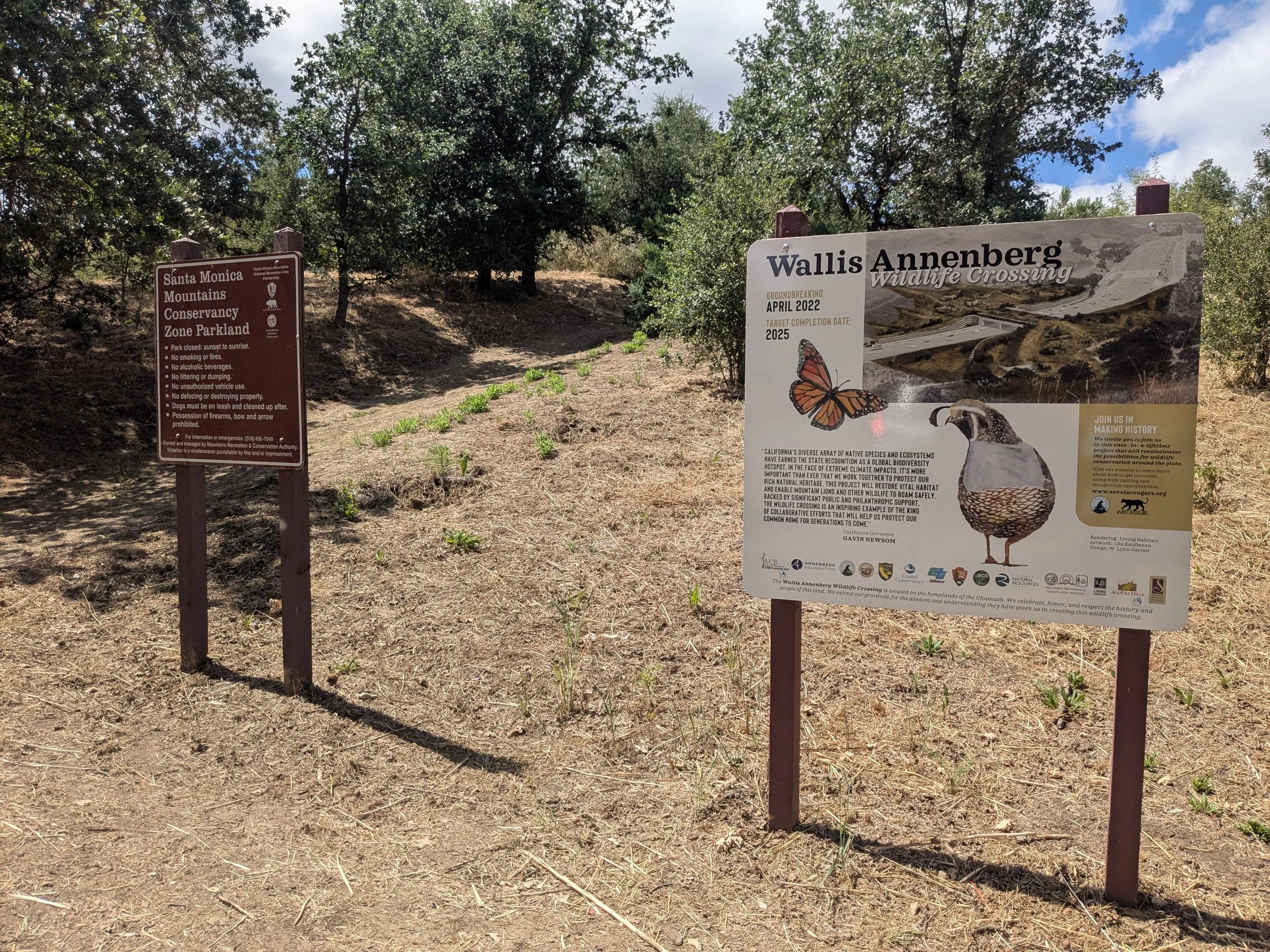
Follow it past the Santa Monica Mountains Conservancy sign and uphill through a briefly shaded area of oak trees.
You will soon reach a wide, flat clearing with views of the wildlife crossing. Continue hiking uphill about 0.2 mile to another clearing with the bench and views of the crossing.
From here, you can retrace your steps back to the parking lot for a total round-trip hike of 0.6 mile, or continue another 0.5 mile along the trail to a second bench that faces south toward the interior of the mountain range. A third bench requires a steeper and very strenuous brief climb up a dirt and gravel path.
-
From the US-101 (Ventura Freeway), take exit 34 (Canwood Street/Liberty Canyon Road).
Follow Liberty Canyon Road south to the first intersection at Agoura Road.
Turn right on Agoura Road and follow it about 0.3 mile to a wide parking pullout on the left. The trailhead is just beyond signs for the Santa Monica Mountains Conservancy and Annenberg Wildlife Crossing.
-
There is free parking in a graded dirt lot at the trailhead off Agoura Road.
There are no toilets or other amenities at the trailhead.
-
Skill level 4; moderate to challenging
While not hard from a way-faring perspective, this well-designed trail is very steep
Bring water, a hat, sunscreen, extra jacket, closed toe shoes and printed map
No shade

Thanks to our sponsor

Liberty Canyon Trailhead